
Earth Observation (EO) has become a valuable tool for the land monitoring services that allow the generation of complete, consistent, accurate, and timely information. The recent technological advances led to the increase of data resolution (spatial, spectral and temporal), of dimensionality and complexity of data. Thus, the amount of data and attributes led to creation of huge databases. The information and knowledge hidden in such databases can be uncovered via extraction of pertinent, potentially useful patterns by automatic processes, as Knowledge Discovery in Databases. Its core is the Data Mining process that automatically extracts interesting patterns or information from huge amount of data.
The Satellite Image Time Series (SITS), i.e. the series of images of the same terrestrial area acquired at different times, are very promising from point of view of the monitoring evolution of Land Cover and Land Use (LC&LU) entities. Based on SITS data it is possible to extract useful information that help not only to understand the changes in LC&LU and the role played by human activities in these changes, but also to facilitate the formulation and implementation of appropriate environmental policies and strategies.
SITS permit to obtain sequences of evolution at pixel level. In this manner, the pixel has three dimensions: radiometric (value), spatial (location and connection) and temporal (order) and its value evolution can be used as criteria for characterization, discrimination and identification of LC & LU entities. Owing to the exponential behavior of evolution sequences and sub-sequences number with the specialization increase, the automatic Sequential Data Mining (SDM) techniques need to be applied.
The limitations in SITS analysis are provoked by the very large input data, the exponential search space and a too large solution set. This situation may induce performance degradation: infeasible or generally inefficient mining and difficulties in identification of interesting knowledge.
In this context, the COSEPE project aims at developing reliable and innovative land monitoring system by taking advantage of Constrained Sequential Pattern Extraction, a Sequence Data Mining approach developed by our team member, Andreea Julea. The project is designed to assure the transition from scientific research to experimental and operational services. The method is unsupervised, at pixel level and takes profit from spatial aspect of data by using connectivity constraints. The increase of extraction efficiency is the result of the conjunction of anti-monotone support and connectivity constraints. New post-processing techniques will be provided for obtaining different types of spatio-temporal localization maps, alignment of patterns and sub-patterns for final clustering, high lightening of stratification structure of complete length patterns, conditioned erosion and dilation of pattern localization and simple geometrical shape recognition.
The developed system will be experimented to offer support for forest management and crop monitoring, two directions with social-economic importance for Romania. The particular aspects pursued by COSEPE concern the massive illegal deforestation and lack of a real-time updates of forest areas and farmland used as well as a record of covering with various types of crops in evolution. Thus, COSEPE will assist the specialists to model the observed phenomena and the decision-makers to formulate and implement appropriate adaptive policies and strategies for sustainable forest management and crop monitoring.
Objectives
Work plan of the project (phases)
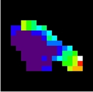
Phase 2 is currently in development and partially tested on 21 SITS interferometric images of Bucharest area. The following methods have been applied:
Figure 1 and 2: the localization pattern on SITS and corresponding building.
![]()